| Script, Image and the Culture of Writing in the Ancient World | |||||
|---|---|---|---|---|---|
Epigraphic Sources for Early Greek Writing4. LSAG in MapsGeographical themes play a vital role in LSAG. The more important include the archaeological find-spots of the texts discussed, the location of the "homelands" of the various scripts and sub-scripts identified, their distribution, and lines of influence between scripts. These are best illustrated with maps. Due to the high number of permutations which are desirable and possible we intend in the long term to facilitate customised electronic map-making by providing downloadable data sets of co-ordinates and analytical information. It will then be possible to plot, for example, all Archaic texts of known provenience discussed in the book which were inscribed on bronze or, say, the distribution of seventh-century texts in Euboian scripts. For those without access to map-making facilities, and as an interim measure, we are developing our own on-line gallery of maps. The selection given here offers a sample of prototypes. We are grateful to Tom Elliott and the Ancient World Mapping Centre (http://www.unc.edu/awmc/) for their generous assistance in preparing the data set of geographic co-ordinates and for other technical aspects. Map Gallery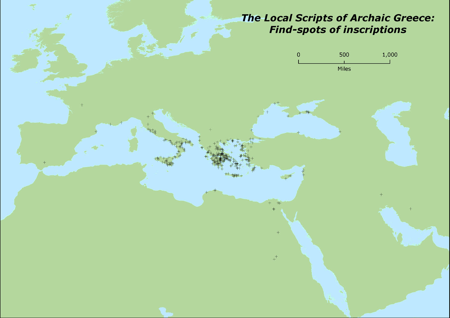 Map 1a: a simple map showing the location of all the archaeological contexts given for the inscriptions catalogued in LSAG.  Map 1b: the same map adapted to isolate the distribution of archaeological contexts for texts with scripts grouped under JefferyŐs heading of "The Peloponnese". 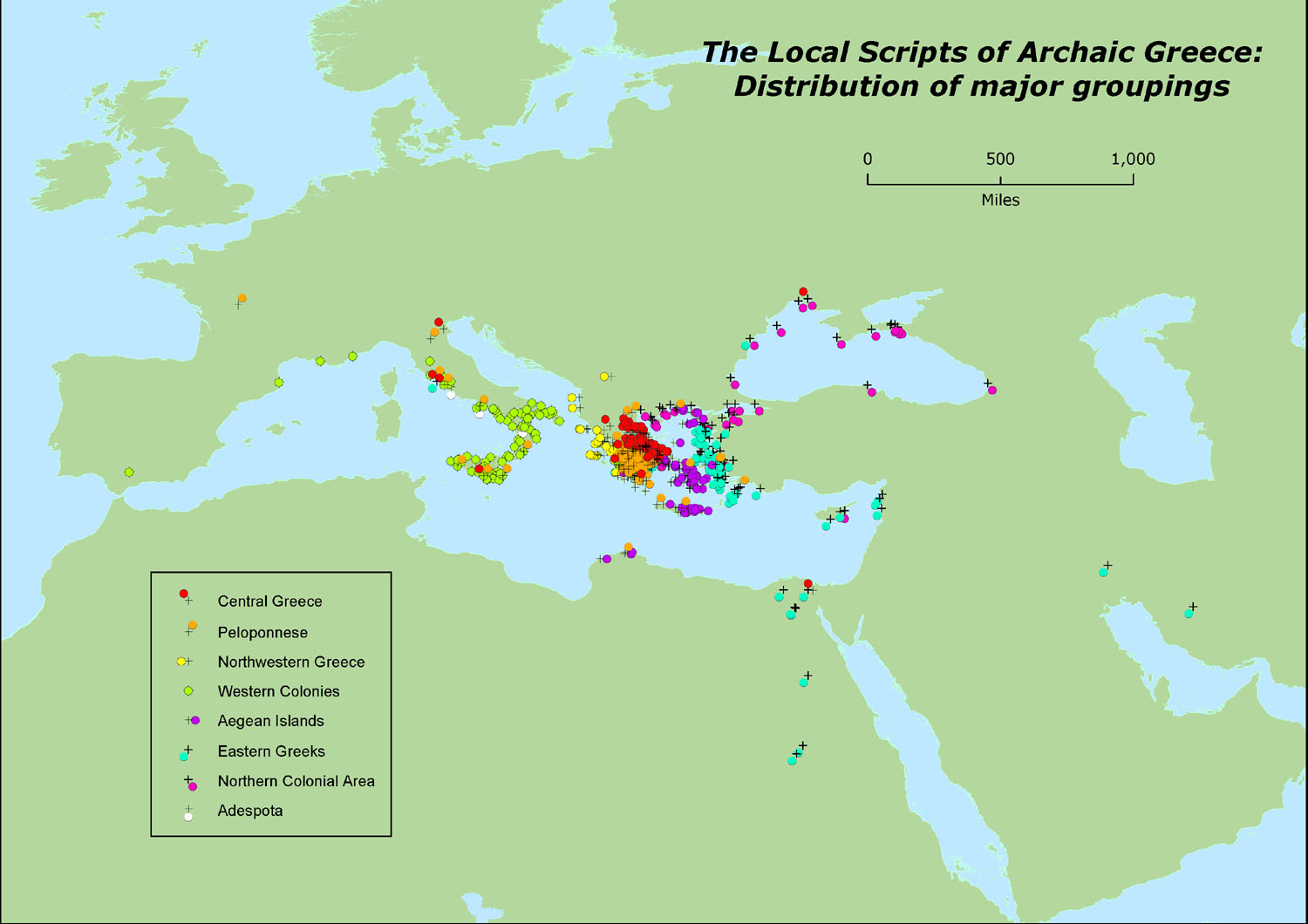 Map 1c: the same map adapted to show the distribution of all of JefferyŐs major groupings of scripts. 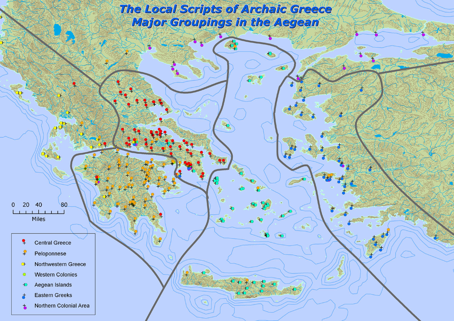 Map 2a: a more detailed examination of the distribution of JefferyŐs major groupings of scripts within the Aegean area. Note that the base map is also more detailed and now shows rivers, contours and bathymetry. 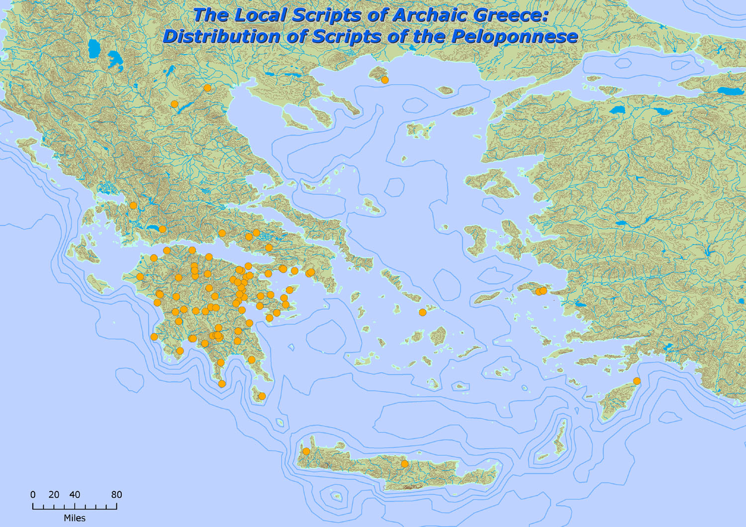 Map 2b: the same map adapted to isolate scripts grouped only under JefferyŐs heading of "The Peloponnese" 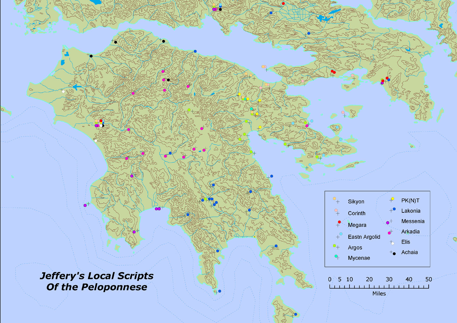 Map 3: a more detailed look at JefferyŐs scripts of the Peloponnese, focussing on a smaller area and showing the distribution of all the local scripts she identifies within this group. 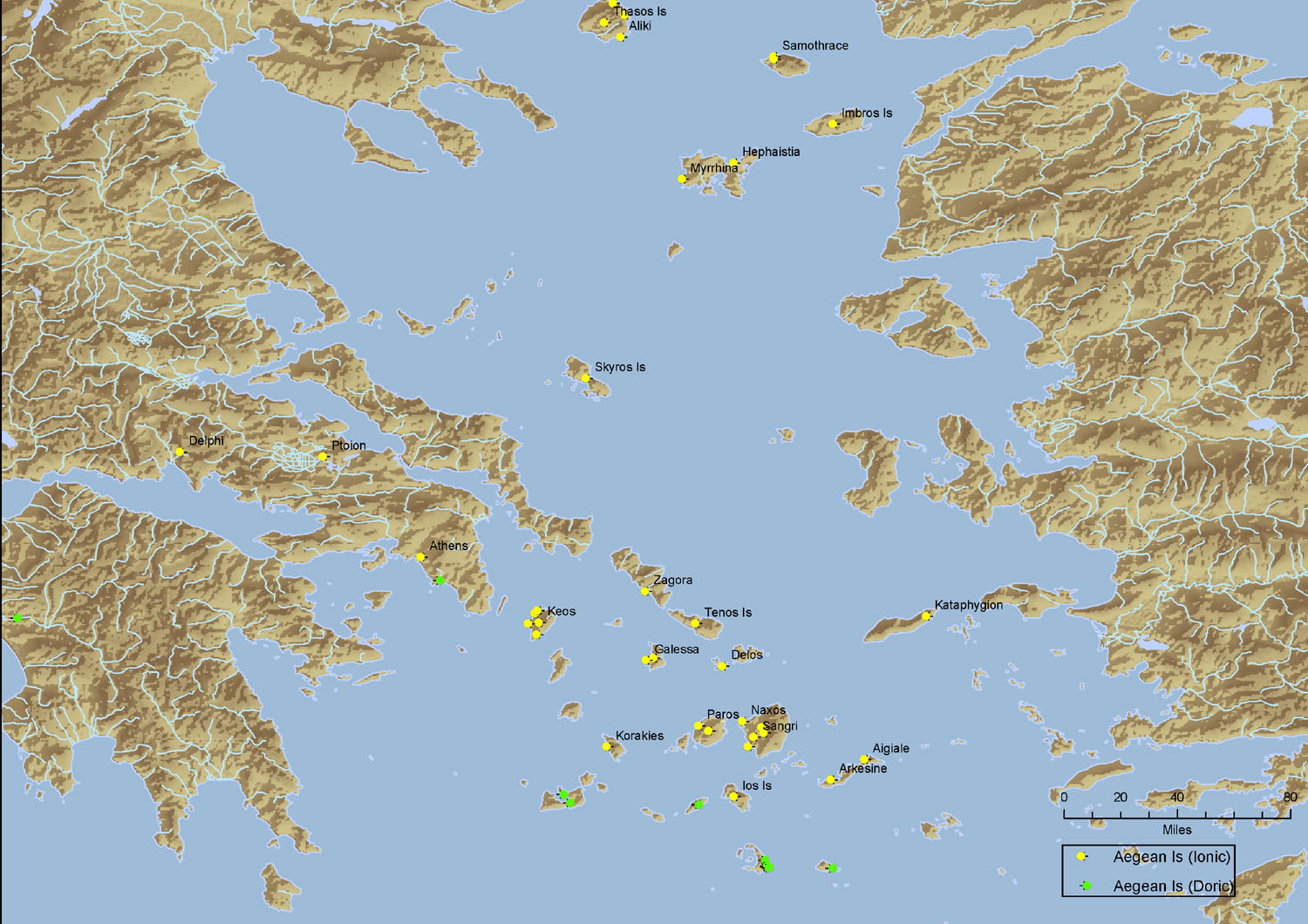 Map 4: a map showing the two major sub-divisions of "Ionic" and "Doric" scripts within the major grouping of "The Aegean Islands". Note that the base map has been changed to show a digital elevation model Đ a demonstration of the flexibility of mapping outputs. | |||||
| Previous page | Introduction | List of Photographs | Next page | ||
Home | Newsletter | Events | Imaging projects | Links | Search |
|||||